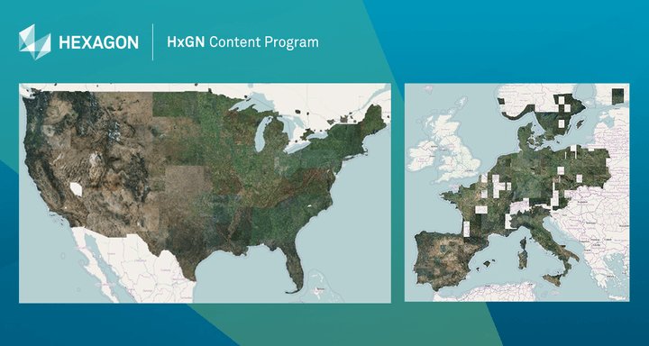
The HxGN Content Program is comprised of a library of aerial imagery collected and processed by Hexagon Geosystems. Since its creation in 2014, the HxGN Content Program has collected 8.3 million square miles (21.5 million km2) of 1 foot (30 cm) resolution aerial data and 315,000 square miles (815,000 km2) of that imagery is focused on urban centers. To assist local and national governmental organizations as well as non-profits, Hexagon is making its aerial imagery library of the United States and Europe freely available to aid in managing the COVID-19 outbreak.
The content has been vetted to provide positional accuracy, making sure it is high enough in quality to be used for public safety, utilities and insurance applications. The orthorectified high-resolution aerial imagery can be used by first responders, healthcare departments and GIS professionals to assess the spread of the virus, visualize the scope of affected areas, plan coordination efforts, and improve responses.
For consistency across the imagery, every state is captured in the same season allowing to leverage the data organization-wide. The orthophotos are available as RGB and near-infrared imagery via streaming subscription or as a download. Derivate data products such as digital surface models and stereo imagery are available upon request, and Hexagon has stated that they plan to keep updating its offerings based on consumer needs. In a press release, John Welter, President of Geospatial Content Solutions at Hexagon’s Geosystem division emphasized the motivation for this move.
“As we are all going through these uncertain times, we are keeping those directly affected by the virus in our thoughts, from family and friends to co-workers and neighbors to partners and customers.”

Aerial imagery from the HxGN Content Program has been made free to stream for 90 days to support the response efforts of the COVID-19 outbreak.
The imagery is particularly useful for the creation of spatial data products and geo-information for those responding to national emergencies. Hexagon plans to make the data available for 90 days through WMS/WMTS protocols directly into all GIS or enterprise application including Esri, MapInfo, and Global Mapper, not requiring any additional software.
“With the release of this high-accuracy aerial imagery, our hope is it will be used as a key source of information for effective response by authorities and others working to contain and treat the virus,” added Welter.
Organizations wishing to access the HxGN Content Program aerial imagery in support of COVID-19 response are asked to contact [email protected].


