RD8200SG Survey Grade Locator
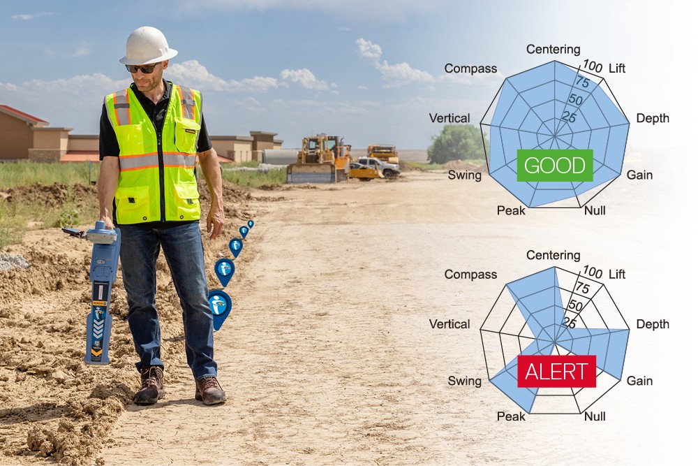
What is it? Locate and map buried utilities in a single operation with the RD8200SG Survey-Grade Precision Locator. With its integrated GNSS antenna, users can view and build high-accuracy maps on a mobile device while locating. Using the RD8200SG with Radiodetection’s Locate Performance Management™ gives field technicians instant feedback, which can lead to reduction in strikes and damages. Managers also gain full visibility of locates and locating skills, helping to ensure safety and high standards.
Who is using it? Used by utility locators, SUE professionals, surveyors, and GIS specialists in construction, engineering, and damage prevention, the RD8200SG locates and maps underground utilities in one efficient workflow, with data that can be imported into GIS and mapping apps.
With the addition of Locate Performance Management, organizations can gain real-time quality assurance on locates, elevate field performance, and integrate accurate data into GIS or asset management systems.
Product information:
Contact: Wendy Hart, [email protected]