Meridian Lite Mobile Mapping System
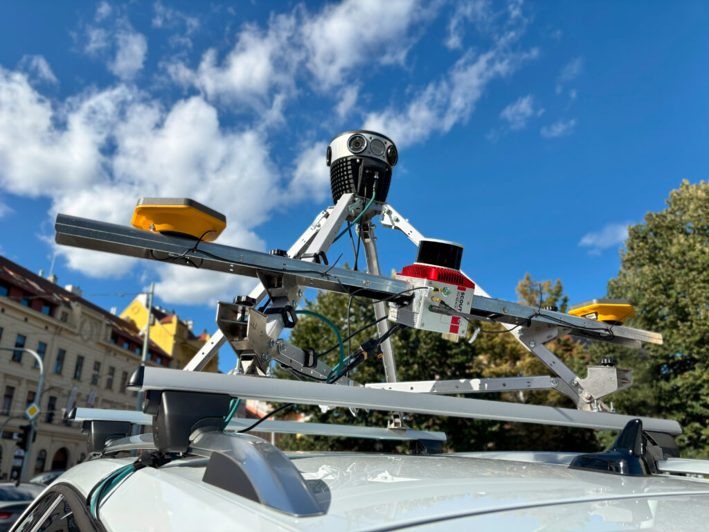
What is it? Meridian Lite redefines mobile mapping with a focus on high-resolution imagery, supported by just the right amount of LiDAR data to fulfill your needs but not overload your processing workflow.
Designed for large-scale asset management, smart city mapping, and infrastructure surveys, it combines the rugged Mosaic 51 360° camera (12.3K resolution) with Phoenix Scout-M2X LiDAR. Modular, flexible, non-cloud dependent, easy to mount and operate. No vendor lock-in. Capture today, deliver tomorrow.
Who is using it? Used by urban planners, city engineers, surveyors, and smart city officials across transportation, utilities, and public works – those who rely on high-resolution, daily data capture for asset management and planning.
Trusted by municipalities like the City of Ottawa (Canada) and City of Toulouse (France), as well as GIS analysts, mapping providers, and infrastructure inspection teams.
Product information:
Contact: Lynn Puzzo, [email protected]