iXM WingPOD
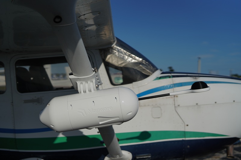
What is it? The iXM WingPod uses a calibrated RGB/NIR sensor array, high-precision IMU, and full-band GNSS for 3cm accuracy. It delivers a 20,000 pixel image width without aircraft power or modifications, enabling enterprise capabilities at a fraction of the operating cost. It enables high-resolution, class-leading quality imaging on small aircraft, reducing mission cost, complexity, and emissions. This system uses satellite-based corrections to reduce post-processing, further improving efficiency.
Who is using it? Surveyors, environmental scientists, agricultural analysts, disaster response teams, and defense operators use the iXM POD for mapping, monitoring, and intelligence missions across urban, rural, and remote environments.
Product information:
Contact: Lamont Norman, [email protected]