SmartSurvey
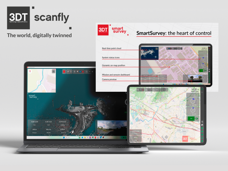
What is it? SmartSurvey is the desktop software to configure and control the data acquisition of Scanfly sensors in real-time, turning fieldwork into a safer and more efficient experience, with a smooth and intuitive interface.
Key benefits include monitoring sensors and resources, planning missions via KML import, configuring data acquisition parameters, real-time point cloud visualization and on-map position, verifying camera view and field synchronization, and analyzing coverage and overlaps.
Who is using it? SmartSurvey is used by professionals needing precise spatial data across several fields. Surveyors and Geomatics Engineers in Construction and Infrastructure sectors rely on it for Topography, Road Cadaster, and 3D Reconstruction. Furthermore, Asset Managers and Civil Engineers utilize it within Utilities for Asset Management and Monitoring activities, while teams performing Tactical Survey in specialized fields depend on its capabilities for accurate, on-the-ground data collection.
Product information:
Contact: Silvia Lazzarini, [email protected]