From the future of the Landsat program to AI-driven analysis of global croplands, agricultural practices, and urban heat, this session highlights the next generation of Earth observation. Presenters will demonstrate how advances in satellite systems, cloud computing, and GeoAI are enabling new insights into environmental change, resource management, and decision-making at local to global scales.
9:00 AM – 9:15 AM
The Future of the Landsat Program
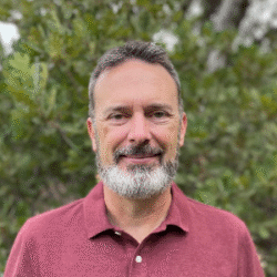
Presented by Phil Dennison, University of Utah
The US Landsat program has provided essential remote sensing data since 1972. The long time series of Landsat data is utilized in countless applications, but the future of the Landsat program is uncertain. Landsat Next was designed as a constellation of three satellites with 6-day repeat coverage, finer spatial resolution, and 26 bands to enable new applications. As of mid-2026, three sensors are being built but only one satellite will be launched, referred to as Landsat 10. This talk will provide the latest information on Landsat 10 and the future of the Landsat program, including new spatial and spectral capabilities, changes in the coverage and repeat cycle from Landsat 9, and the outlook for the future of the Landsat program into the 2030s. The speaker, Dr. Philip Dennison, is a member of the Landsat Science Team.
9:15 AM – 9:30 AM
Global Cropland Products at 10-30 m Using Landsat, Sentinel, and Alpha Foundation’s Google DeepMind Embedded Data Through Artificial Intelligence and Cloud Computing
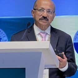
Presented by Prasad Thenkabail, U.S. Geological Survey
The global Earth Observation (EO) landscape is undergoing a profound transformation driven by the availability of massive, harmonized, and analysis‑ready satellite time‑series datasets. Today, scientists have access to an extraordinary suite of multisensor data at 10–30 m resolution from Sentinel‑2 and Landsat missions, providing continuous, consistent coverage of the entire planet. These archives capture seasonal, annual, and long‑term changes in vegetation, land use, water resources, and agricultural systems, forming the backbone of modern environmental monitoring. Complementing these systems is PlanetScope’s 3 m imagery, which offers near‑daily, field‑scale observations ideally suited for generating high‑quality reference datasets and validating coarser satellite products.
A major breakthrough in EO science is the emergence of the 64‑band AlphaEarth Foundations Satellite Embedding dataset, available at 10 m resolution in Google Earth Engine. Covering the entire planet from 2017 to 2024, this dataset represents a paradigm shift in how satellite information can be processed and interpreted. Each 10×10 m pixel is embedded in a 64‑dimensional feature space derived from optical imagery, radar backscatter, LiDAR‑based structural metrics, long‑term meteorological variables, and textural information. These data are harmonized, normalized, and standardized, enabling immediate use in artificial intelligence (AI), machine learning (ML), and deep learning (DL) workflows without extensive preprocessing. The multidimensional nature of the dataset allows AI models to learn complex relationships that were previously inaccessible, accelerating global‑scale analysis and enabling new scientific insights.
This project brings together scientists focused on global agricultural cropland mapping and water‑use assessments at the highest known resolutions (3–30 m). Their shared mission is to leverage EO data and AI to support global food and water security. As population growth, climate variability, and resource pressures intensify, the need for accurate, timely, and spatially explicit information on croplands and water use has never been greater. EO provides a unique vantage point for monitoring agricultural landscapes, assessing water use, and understanding how environmental changes affect food production.
The session highlights a paradigm shift in producing global cropland products using multi‑sensor satellite data, petabyte‑scale analytics, and cloud computing platforms such as Google Earth Engine. It will present cropland extent, irrigated versus rainfed classifications, cropping intensity layers, and crop‑type maps produced at 10–30 m resolution and covering the entire planet. Together, these advances mark a new era in EO, enabling unprecedented insight into global agriculture, water use, and resource sustainability.
9:30 AM – 9:45 AM
The Application of GeoAI for Tillage Detection Using Semantic Segmentation
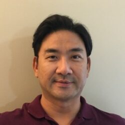
Presented by Jae Sung Kim, Michigan Technological University
One of the most important agricultural best management practices is tillage, and it is used widely on the field crop areas globally. The role of tillage affects seedbed preparation, seed planting, management of water and pests, and application of nutrients and other supplements. Also, tillage impacts the environment in terms of quality of water, soil, and air. Therefore, it is crucial to define the location of tillage and delineate its areas of use for decision makers. However, it is challenging tasks to detect and delineate the tillage areas with ground-based detection methods because of the large size of crop fields. Hence, satellite remote sensing is very useful for tillage detection because of its capability to capture, process, and analyze data over large areas. Recently, AI techniques using deep learning algorithms led the development of geospatial application of AI (e.g. GeoAI). In this study, a tillage detection workflow was developed using GeoAI’s semantic segmentation, which is based on deep neural networks. The workflow was applied to Queen Anne’s County in Maryland to detect tillage. The high values of classification accuracy and kappa statistics showed satisfactory results of tillage detection by the workflow developed in this study. We expect that the developed workflow will contribute to the tillage detection work of agricultural and remote sensing communities.
9:45 AM – 10:00 AM
Leveraging AI and Multi-Scale Thermal Sensing to Map Urban Heat from Satellites to Subways
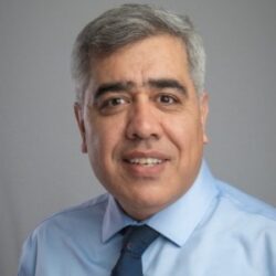
Presented by Hamid Norouzi, City University of New York / Eco Rising Solutions
Extreme heat is now one of the most consequential and least visible hazards facing cities, yet the data needed to act on it exists at mismatched scales: satellites observe entire regions, while people experience heat block by block, and in places satellites cannot see at all. This presentation shares a practitioner-focused, multi-scale workflow developed through NASA and AWS supported research that connects these scales end to end. First, we demonstrate AI/ML downscaling of satellite land surface temperature from thermal sensors including Landsat and ECOSTRESS to the street and block level, validated in New York City and in hyper-arid Gulf cities, with cloud-based processing on Google Earth Engine and AWS. Second, we show how block-level heat analytics identify priority zones for cooling interventions and feed a pedestrian “cool corridor” routing tool that turns maps into daily decisions. Third, we go where satellites cannot: a low-cost distributed sensor network deployed across the New York City subway system that quantified thermal hazards on underground platforms, revealing a hidden heatwave beneath the city. Attendees will leave with concrete lessons on downscaling model validation, sensor deployment and maintenance in harsh transit environments, integrating multi-sensor satellite data with ground station networks, and building the agency partnerships that move heat data from research product to operational decision tool.