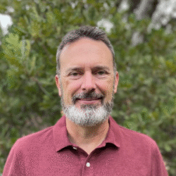
Phil Dennison is a remote sensing scientist with three decades of experience in remote sensing and geospatial applications. He is a professor in the School of Environment, Society & Sustainability at the University of Utah, where he directs the Utah Remote Sensing Applications Lab (URSA). His past work includes remote sensing of ecosystem disturbance, including drought and insect attack; remote sensing of fuels, active fire, and vegetation recovery following wildfire; detection and mapping of point source greenhouse gas emissions based on shortwave infrared absorption features; and spectral mixture modeling and estimation of fractional cover. Dr. Dennison recently led the selection of shortwave infrared bands for Landsat 10. He is also extensively involved in developing applications of remote sensing and geographic information science to improve firefighter safety. Dr. Dennison is a member of the NASA FireSense Implementation Team and USGS/NASA Landsat Science Team.
