From conflict zones and earthquakes to floods and wildfires, geospatial technologies are transforming how organizations assess damage, prioritize response efforts, and support recovery. This session highlights the use of satellite imagery, drones, GeoAI, and natural-language spatial analysis tools to deliver actionable intelligence, improve situational awareness, and accelerate decision-making in disaster and humanitarian operations.
12:30 PM – 12:45 PM
How Drone-Based Photogrammetry Helped SAR and Structure Evaluation During the Venezuelan Earthquakes
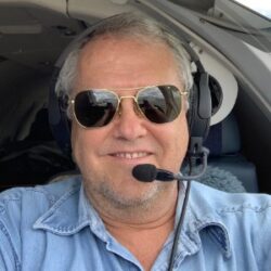
Presented by Juan Plaza, Plaza Aerospace Corp.
On Wednesday June 24, the Venezuelan coastal city of La Guaira was hit by almost simultaneous 7.2 and 7.5 earthquakes that demolished over 250 buildings in a matter of seconds and rendered thousands of other uninhabitable and doomed to be demolished. Drone companies from 27 countries were deployed within hours of the event and helped, not only to locate victims using infrared technology, but also using lidar and photogrammetry techniques, determining which still-standing structures were safe and which had to be brought down for good. During this presentation we will present a series of videos of the before and after of the earthquakes, but also the combined lidar/imagery videos of the structures that collapsed and the few that can still be saved. A combination of vertical and horizontal photogrammetry techniques were used and we will explain how mixing these images with a point cloud allowed structural engineers determine the soundness of the structure.
12:45 PM – 1:00 PM
Ask the Map: Natural-Language Q&A for Disaster Response
Presented by Ross Winans, NV5
When a flood crests or a fire perimeter shifts, the emergency managers who need spatial answers fastest are often the least likely to open a GIS or write a spatial query. Their critical, time-constrained needs often end up in the ticket queue awaiting a dedicated GIS analyst’s support. The data exists: flood zones, wildfire susceptibility, locations of critical facilities, and more. However the need for deep technical know-how often sits between spatial data and an actionable result.
NV5 would like to present GeoIQ, a system that lets anyone “Ask the Map” in natural language. GeoIQ’s goal is to empower subject matter experts to work in GIS environments, allowing them to execute basic GIS operations through plain language. For experienced GIS power users, GeoIQ provides a much more ergonomic interface to work with large, complex GIS data.
GeoIQ uses a variety of open source software under the hood, featuring integrations with QGIS and many popular Javascipt web mapping libraries such as MapLibre. By leveraging these existing widely used GIS tools, GeoIQ brings the “human-in-the-loop” forcefully, which is critical for ensuring an AI’s responses are accurate and precise. GIS tooling provides a wealth of visualization and measurement capabilities for validating an AI’s results in near real-time, as well as extending the capabilities of off-the-shelf LLM models for spatial analysis.
This talk will begin with a live demo to introduce GeoIQ and showcase natural language Q&A in an open source GIS environment. The demonstration will emphasize disaster management workflows. Afterwards, we will feature a short discussion of GeoIQ’s technical design and approach to AI safety. We’ll be candid about the stakes. An AI that confidently gives wrong information during a disaster is worse than no AI at all, so we will conclude on techniques for safely developing, shipping and monitoring spatial AI.