
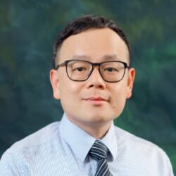
Dr. Wai Yeung Yan is the Co-founder and Managing Director of Nova Spatium, a pioneering technology firm specializing in deep learning-based point cloud artificial intelligence. With over fifteen years of experience bridging the gap between cutting-edge academic research and practical industry applications, Dr. Yan has established himself as a leading global voice in the geospatial, remote sensing, and Architecture, Engineering, and Construction (AEC) domains. His work at Nova Spatium focuses on pushing the boundaries of semantic segmentation, automated object extraction, and highly accelerated scan-to-map, Scan-to-BIM, and asset management workflows to help organizations bypass the labor-intensive bottlenecks of manual spatial data processing.
Throughout his distinguished career, Dr. Yan has held prestigious academic and research positions on an international scale. He previously served as an Assistant Professor in the Department of Land Surveying and Geo-Informatics at The Hong Kong Polytechnic University (HKPolyU), where he led high-impact research initiatives in advanced geomatics, photogrammetry, and spatial analytics. Currently, he serves as an Adjunct Professor in the Department of Civil Engineering at Toronto Metropolitan University (formerly Ryerson University). He earned his PhD in Civil Engineering from the same Canadian institution in 2012, specializing in point cloud processing, laser scanning, and remote sensing.
Dr. Yan’s academic and technological breakthroughs have earned him some of the most prestigious accolades in the geospatial field. In 2012, he was awarded the Governor General’s Academic Gold Medal, one of the highest honors bestowed upon a graduate student in Canada, celebrating his outstanding scholastic achievements. His international footprint was further solidified in 2016 when he received the globally renowned Otto von Gruber Award from the International Society for Photogrammetry and Remote Sensing (ISPRS), an honor presented only once every four years to a young scientist of outstanding merit. Continuing his streak of recognized excellence, he was awarded the Bronze Medal from the Canadian Remote Sensing Society in 2020 for his significant, ongoing contributions to the development of geomatics and remote sensing technologies.
As a highly respected leader in the global scientific community, Dr. Yan is a Senior Member of both the Institute of Electrical and Electronics Engineers (IEEE) and the International Society for Optics and Photonics (SPIE). Over his career, he has authored dozens of widely cited scientific publications focusing on innovative algorithmic development for airborne LiDAR, intensity data correction, multispectral scanner normalization, and the elimination of complex data artifacts. His deep domain expertise has directly fueled his entrepreneurial endeavors, allowing him to translate theoretical algorithms into powerful, production-grade software solutions.
Under his visionary leadership, Dr. Yan and his engineering team at Nova Spatium developed 3DMas, a revolutionary software suite designed to tackle the industry’s most challenging data annotation and semantic labeling bottlenecks. Leveraging state-of-the-art vision foundation models and artificial intelligence, 3DMas enables rapid, automated point cloud segmentation and text-prompt annotation. The software has quickly gained traction across a diverse array of sectors, ranging from AEC firms looking to accelerate Scan-to-BIM and quantity takeoffs, to transportation departments developing high-definition (HD) maps for autonomous vehicle navigation, to urban planners designing next-generation smart cities.
Dr. Yan remains passionately committed to transforming raw, unstructured spatial datasets into highly intelligent, attribute-rich digital assets. By driving the integration of advanced spatial AI into everyday operations, he is empowering the global geomatics and construction industries to step away from manual drafting and step confidently into an automated, scalable future of digital twins.