Transportation agencies have more corridor data than ever, much of it collected for a single as-built deliverable and then left in storage. The four projects in this session all start from that data and push it into engineering use.
Speakers cover clearance and clash detection built from rail point clouds, a century-old SEPTA transit line surveyed while third-rail service continued, a survey-grade digital twin of FDOT SunTrax autonomous vehicle testing facility assembled from multiple sensor platforms, and AI-assisted defect detection on an Ohio DOT bridge. Across all four, the technical work sits alongside the practical constraints of live operations, restricted access and the accuracy standards that engineering decisions require. Attendees will leave with a clearer sense of what existing capture data can support well beyond its original scope.
This session will include the following presentations:
Transforming Rail Lidar Data into Clearance and Clash Detection Intelligence
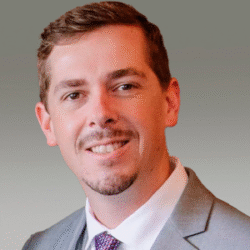
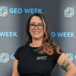
Presented by Jennifer Triana, TopoDOT Solutions, and Gordon Perry, HNTB
Rail infrastructure presents some of the most demanding environments in transportation surveying. Limited track access, active operations, GPS denied corridors, underground facilities, and stringent safety requirements make collecting and maintaining accurate infrastructure information a significant challenge.
Over the last decade, mobile lidar and reality capture technologies have transformed how rail systems are documented. While many organizations initially collect point cloud data to support surveying, mapping, and as built deliverables, the long term value of these datasets extends far beyond their original project purpose.
This presentation will demonstrate how reality capture data can be leveraged for rail clearance analysis, clash detection, and engineering decision making. Through real world rail case studies, attendees will see how high density lidar datasets were used to evaluate potential conflicts between tunnels, infrastructure assets, rolling stock, maintenance equipment, and proposed improvements without requiring repeated field visits.
Attendees will gain practical insight into workflows, implementation considerations, and methods for extending the value of reality capture investments beyond traditional survey deliverables. The presentation will demonstrate how lidar data can support digital delivery, intelligent as builts, asset management, infrastructure planning, and long term operational decision making.
Digital Twins for Centennial Transit
Presented by Eric Andelin, Pointerra, and Brent Everitt, Spicer Group, Inc.
Managing century-old transit infrastructure requires balancing modern safety standards with legacy design constraints. In this session, Spicer Group details their approach to surveying and asset management along Southeastern Pennsylvania Transportation Authority’s (SEPTA) historic Norristown High Speed Line. Utilizing advanced mobile mapping and rail data collection, Spicer Group will showcase how they transformed dense corridor data into actionable engineering insights. This presentation will cover the unique challenges of surveying a live, third-rail high-speed transit corridor, and how leveraging cloud-based 3D processing infrastructure (Pointerra3D) allowed engineers and stakeholders to virtually inspect track, clearance, and structural assets without boots on the ground.
Multi-Source Geospatial Data Integration at FDOT’s SunTrax Facility
Presented by Mark Topping, WGI, Inc.
As transportation agencies increasingly adopt digital twins to support planning, operations, asset management, and connected vehicle testing, the quality and interoperability of geospatial data have become increasingly important. This presentation examines how WGI developed a survey-grade digital representation of the Florida Department of Transportation’s SunTrax testing facility by integrating complementary surveying and remote sensing technologies into a unified, spatially accurate geospatial framework.
SunTrax is one of the nation’s premier transportation research and autonomous vehicle testing facilities, requiring engineering-grade accuracy while benefiting from realistic three-dimensional visualization. Rather than relying on a single collection method, WGI integrated traditional survey control, static terrestrial laser scanning, terrestrial mobile lidar, airborne lidar, aerial orthophotography, and high-resolution oblique imagery. Through rigorous control, registration, calibration, and quality assurance, these diverse datasets were aligned into a common survey framework.
The resulting deliverables extend beyond a conventional design survey, providing both highly accurate topographic information and a realistic, spatially accurate 3D model suitable for future digital twin applications. The presentation explores how the datasets were integrated and validated, highlights the strengths and limitations of each technology, and demonstrates how complementary collection methods create a more complete representation than any single platform alone.
Attendees will gain practical insight into selecting and integrating survey and remote sensing technologies for transportation infrastructure projects while balancing accuracy, efficiency, visualization, and downstream usability. The session will also illustrate how survey-grade geospatial data can establish the foundation for digital twin applications supporting infrastructure planning, asset management, visualization, simulation, and operational decision-making.
New Tech Solves a Big Problem for Ohio DOT and the Jeremiah Morrow Bridge
Presented by Bret Gardner, gNext, and Jamie Davis, Ohio DOT
This presentation explores the transformative impact of drone technology, photogrammetry, and Artificial Intelligence (AI) in modernizing bridge inspections. The session focuses on how these advanced digital tools enhance data collection, improve defect detection accuracy, and support safer, more efficient inspections.
Drones offer safer access to hard-to-reach bridge elements and enable comprehensive, high-resolution data capture. When paired with cloud-based photogrammetry and AI-driven analytics, DOTs can generate detailed digital twins of bridge infrastructure—enabling automated, consistent, and scalable defect identification and condition assessment.
These digital innovations do not replace traditional methods but augment them; empowering inspectors with better tools to detect, quantify, and track structural issues over time. This leads to faster inspection cycles, reduced field time, lower operational costs, and improved asset health monitoring. Through real-world use cases and customer experiences, this presentation will demonstrate how these technologies are being successfully implemented by Ohio DOT to enhance decision-making and proactively maintain critical transportation assets.