
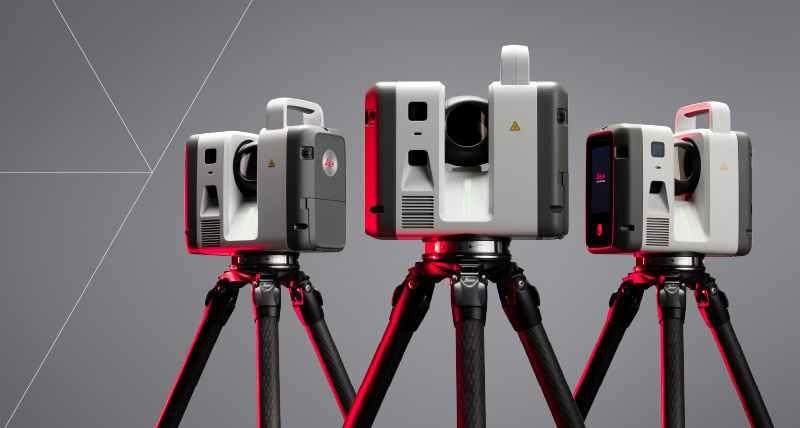
RTC Series
What is it? The Leica RTC series brings together one trusted scanner design with three levels of performance. Combining superior scanning, software intelligence, and cloud collaboration in one connected workflow, it gives teams earlier access to accurate 3D data. From single-scanner projects to multi-scanner coordination, users can capture with confidence, collaborate in real time, and make faster, better-informed decisions while reducing rework.
Who is using it? Built for reality capture users across surveying, construction, engineering and infrastructure, industrial plant and public safety, the RTC series supports projects where accurate data, timely decisions and field-to-office coordination are critical – from buildings and complex sites to bridges, tunnels and other demanding applications.
Product Link: https://leica-geosystems.com/products/laser-scanners/scanners/leica-rtc-series
Contact:
Paula Cooper
[email protected]