Converge
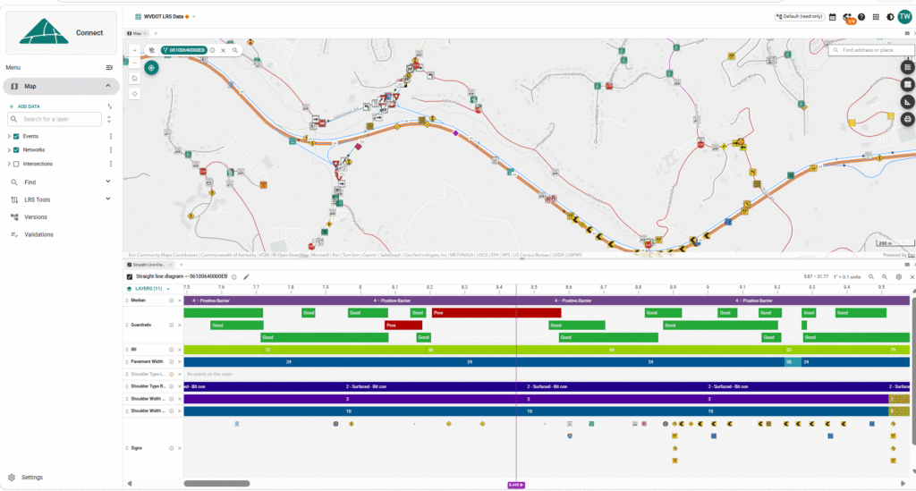
What is it? ElevateGeo Connect is a web-based platform for managing roadway network and asset data. It brings LRS route editing, event editing and straight-line diagram visualizations together in one place, with map, video log, point cloud and diagram panels that stay in sync as you work. Teams can edit route geometry and the events along those routes, view pavement layers in cross-section, and keep everything tied to one authoritative LRS. It is a single source of truth for road network data.
Who is using it? Connect is used by state DOTs and transportation agencies to manage, integrate and improve the quality of the LRS-based road network and asset data they rely on for planning, operations and federal reporting.
Product Link: https://elevategeo.com/products
Contact:
Tyler Williams
[email protected]