
Nearmap
Fallingwater’s visionary design demands an equally forward-thinking approach to its preservation. Safeguarding its architectural integrity, cultural significance, and enduring legacy requires a commitment to honoring Frank Lloyd Wright’s original vision while addressing the challenges of aging materials, evolving environmental conditions, and changing generational perspectives.
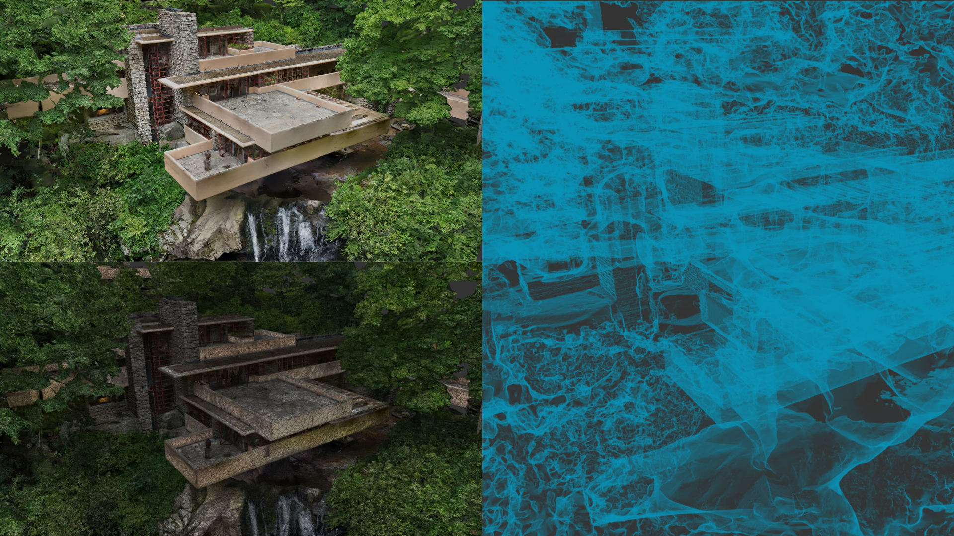
As this architectural masterpiece approaches its second century, our team has spearheaded a digital preservation initiative that integrates GIS and advanced digital twin technologies to develop a comprehensive, data-driven model. This initiative supports the documentation, interpretation, protection, and long-term stewardship of Fallingwater, ensuring its continued role as a source of education, inspiration, and architectural innovation for generations to come.



Justin Gunther serves as Vice President of the Western Pennsylvania Conservancy and Director of Fallingwater, Frank Lloyd Wright’s masterpiece and a UNESCO World Heritage site. Prior stewardship roles include architectural historian for Thomas Jefferson’s Virginia State Capitol, manager of restoration for George Washington’s Mount Vernon, and curator for Fallingwater. In academic positions at the University of Pittsburgh and the Savannah College of Art and Design, Justin focuses on the preservation of Modernism and the creative interpretation of heritage sites.
The Great Salt Lake is shrinking, and that’s a problem for everyone in Utah — its waters and wetlands support millions of migratory birds, its brine shrimp feed a global aquaculture industry, and its exposed lakebed can kick up dust that sweeps into nearby population centers. As water levels change, understanding exactly what’s happening beneath the surface has never mattered more.
This session tells the story of an ambitious effort to map that hidden world. The Utah Geological Survey, Aero-Graphics, and Dewberry are collaborating on a large-scale bathymetric lidar project to map shallow lakebed, wetlands, and deeper-water environments across portions of the Great Salt Lake. The work combines Utah-based aerial acquisition, green-wavelength bathymetric lidar, multi-sensor planning, and advanced processing to improve on legacy datasets and reveal details of the lakebed that have long been difficult to see. It’s a technically demanding inland bathymetric lidar effort, complicated by murky water, shifting shorelines, and a lake that’s constantly changing shape.
The session will begin with why the lake’s decline matters: who is impacted, what’s at risk, and why better lakebed information is essential for science, management, and public decision-making. It will then move into the geospatial challenge of collecting data in a dynamic lake environment. Finally, Utah Geological Survey will share what the new data is revealing about microbialite reef structures, lakebed morphology, wetlands, geologic features, and future research needs. As Geo Week comes to Salt Lake City, this session invites attendees to look beneath the surface of one of the West’s most iconic — and most threatened — lakes and see how better data can help communities respond.




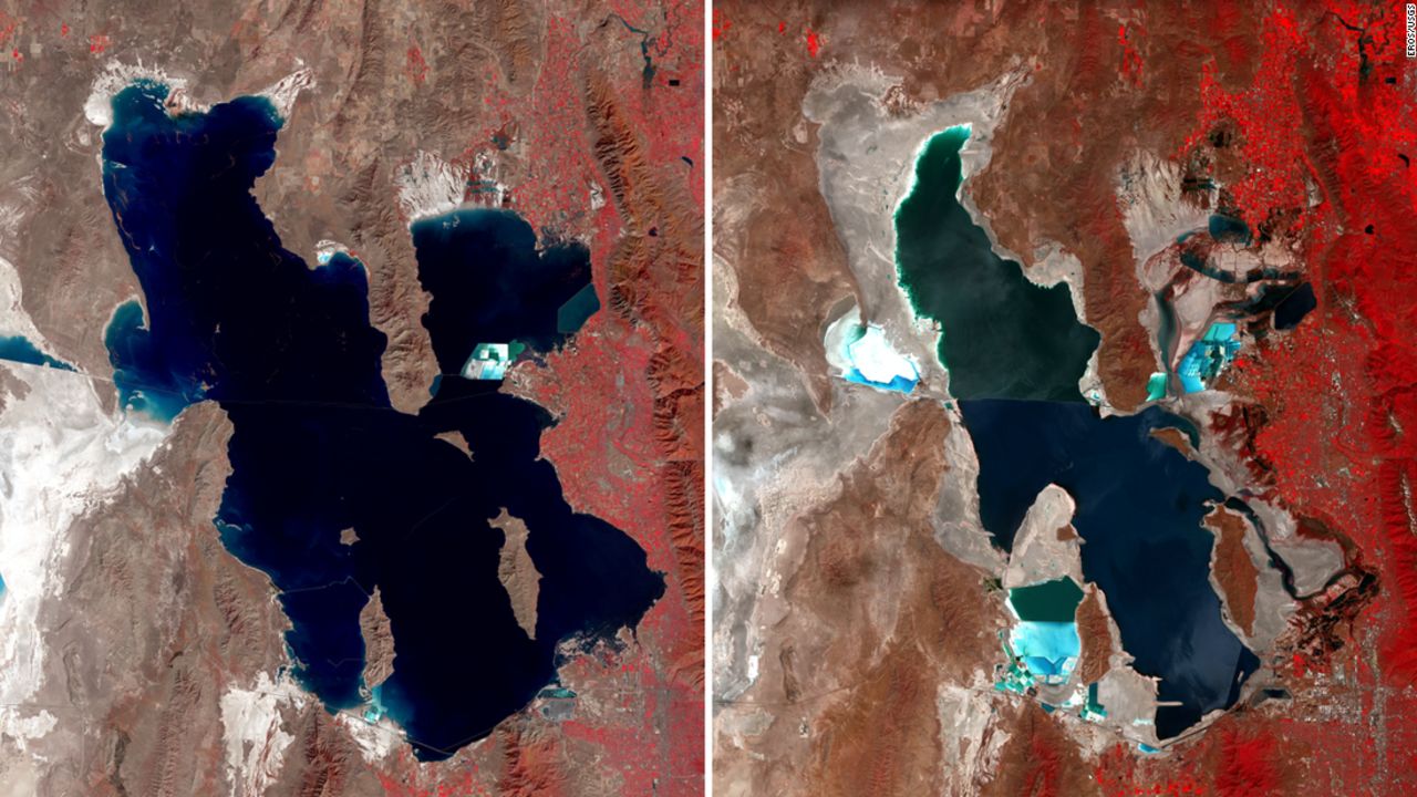
(USGS EROS imagery comparing the Great Salt Lake in 1987 and 2022)