
In offering one of the industry’s most comprehensive databases for enterprise spatial applications and secure graph databases for decades, Oracle has been very consistent in their philosophy with and role around geospatial data and geospatial analysis. Their efforts to provide context for information technology platforms have powered countless applications across industries, many of while are powering the next industrial revolution. Oracle’s Spatial and Graph features power applications from GIS and location services to fraud detection, social networks, linked data and knowledge management.
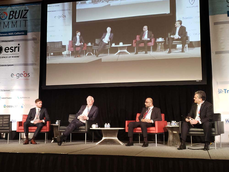
 At the GeoBuiz Summit in Monterey, James Steiner, Vice President at Oracle, talked through exactly how this platform is being utilized across the globe during the Integrated Geospatial Platform and Services: Towards a Digital Economy session. Joined by a number of public officials that focused on their own efforts to provide context with geospatial data, Steiner highlighted what the availability of location data has meant for Oracle to enable a new digital economy in terms of location context, as well as how the company is looking to bridge the geospatial digital divide.
“You have to remember that Oracle has been doing this for 25 years now, and the role that geospatial data plays in providing context has only increased,” Steiner said in a follow-up interview that focused on the insights he discussed during the session. “In the past five years though, it’s moved even faster. In the beginning it would allow our users to better understand issues like the logistics associated with their inventory or their supply chain. Now, the context we’re creating allows users and applications to dynamically understand and work with geospatial information because everything has a location attribute.”
In the past, that location attribute could cause issues because there were challenges with lining up different formats. Sometimes location attributes were expressed in terms of a full-blown address, or a lat long, or an IP address. While all of those formats are related, they all have distinct attributes that couldn’t always be easily correlated. Now though, all of these location attributes can be correlated to the point that services can use any or all of this information to provide info to users at various scales.
These capabilities are the foundation of the new digital economy that the GeoBuiz Summit session was focused on. However, the true business value of this information is about more than context, as capabilities related to machine learning are also changing expectations and helping to open up these opportunities
“Geospatial information can be used to provide information that power machine learning applications,” Steiner told Geo Week News. “That can mean automatically understanding where things are, what the proximity is, what that location dimension might mean, learning more about business process or operational activities, etc. That means everything from automatically sending an alert to someone who is passing by a restaurant that is of interest to them to enterprise applications that can be as complex as staging resources in anticipation of an upcoming weather event or other crisis.”
These varying capabilities can be seen in a real way with Oracle’s converged data platform, called Oracle Cloud Infrastructure, and Oracle’s converged database which are designed to handle different types of information, different types of analytics, different types of workflows and different kinds of data. Not everyone uses this platform in the same manner, as people are always going to have different needs at different times. Sensibly pulling all of that together in a single place is all about simplifying the management and infrastructure of geospatial data.
Using spatial data in this manner typically requires a great deal of expertise though. That’s why Oracle has been incorporating these capabilities into Oracle Autonomous Database as well as other autonomous services. They’ve introduced new kinds of tools and interfaces that are more self-service, to the point that many utilize no code or low code environments. These environments make it that much more digestible for the business user, for the analytic data scientists, for the analyst and for people who want to not only do geospatial analysis but combine that with other business intelligence that directly impacts this new digital economy.
How governments are thinking of and using these platforms was also discussed on a panel, as the role of government in providing underlying geospatial infrastructure was talked through in great detail. As an example of what that can look like, officials from the Census Bureau were able to utilize location information from the Postal Service to save money by validating the locations of their constituents. That’s the exact sort of integration that Oracle and Steiner are most excited about.
“As we provide infrastructure and allow people to maintain privacy and enforce security, we also need to facilitate the sharing of information and give users the autonomous platforms to use geospatial tools that can work in a consistent fashion and get consistent results,” Steiner said. “As we do that, I think we’ll get that much closer to a digital economy that is not only reliant on spatial information but also exists because of the opportunities this information has directly enabled.”
Those opportunities related to a new digital economy are not just about providing information and services based on our physical relationships but also social relationships. From a commercial perspective, being able to help bring together people who might have common interests who are also geographically connected will open up entirely new business models. Location attributes that provide context-specific information to improve countless processes are being created right now and they’re changing expectations around what location data can deliver.
Progress has been made and expectations are changing, but the true benefits of an integrated geospatial platform that spans across governments, businesses, and citizens are just beginning to be realized.
[gdlr_personnel columns=”1″ type=”dynamic” style=”box-style”] [gdlr_tab title=”Jeremiah Karpowicz” position=”Executive Editor” author_image=”https://ilmf-static.s3.amazonaws.com/uploads/sites/2/2019/11/jk.jpg” ]Jeremiah Karpowicz is the Executive Editor for the Technology Group at Diversified Communications. He has created articles, videos, newsletters, ebooks and plenty more for various communities as a contributor and editor. You can read more from him on Commercial UAV News, AEC Next News or SPAR 3D.com.[/gdlr_tab] [/gdlr_personnel]


