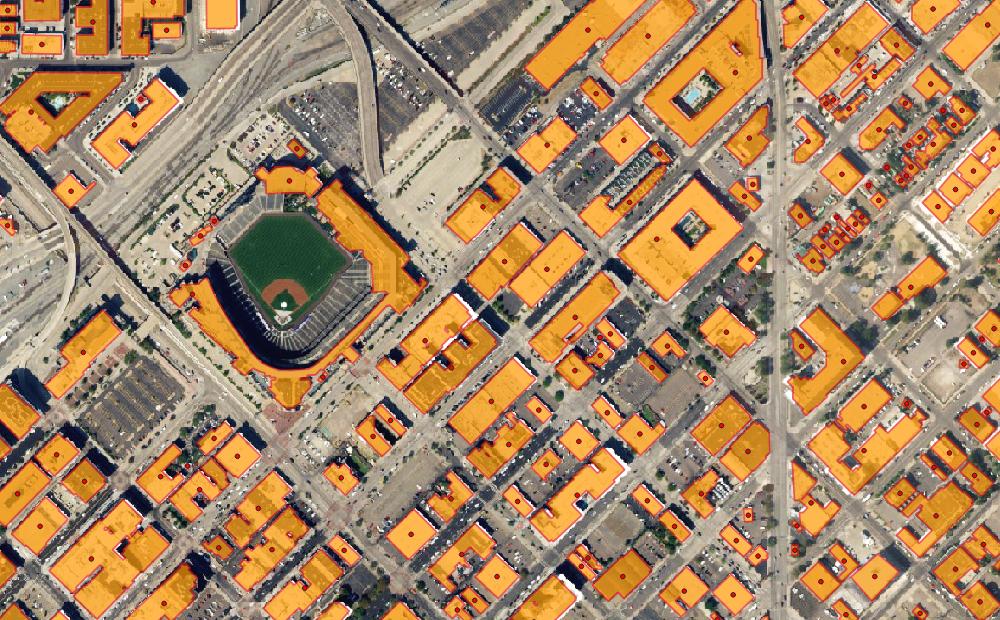
High-resolution geospatial spatial data provider EarthDefine recently announced the release of an updated building footprint database, which contains over 156 million footprints of commercial and residential structures across the continental United States and will allow insurers to identify with rooftop accuracy where structures fall within a parcel of land to improve risk rating, quoting accuracy, and claims response.
EarthDefine is a mapping company using AI to create unique GeoSpatial data products. It deploys image processing workflows that exploit advancements in computer vision and artificial intelligence (AI) to extract ground cover information from aerial imagery and other sensor data. Its mission is to create a live map of the Earth, where newer data is continually processed to update the map. EarthDefine is currently focused on the US market, releasing their US Building Footprints dataset and the US Tree Map dataset that map two foundational land cover categories in unprecedented detail across the lower 48 states. These products are helping clients across a range of industries: example applications include meeting FCC compliance for broadband reporting, understanding urban growth, improving insurance underwriting and modeling carbon storage.
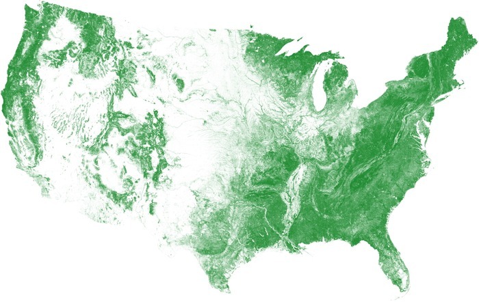
An AI model was used to classify over 120 terabytes of high-resolution color-infrared aerial imagery spanning over 3.1 million square miles to create the US Tree Map.
Creating seamless maps for very large geographies
Vikalpa Jetly, CEO & Founder of EarthDefine explains why the company uses both aerial imagery and lidar.
Trees captured and interpreted from aerial imagery.
“Terrestrial lidar is great for high accuracy 3D mapping for smaller areas but is limited in coverage with mostly private holdings. Since our goal is to create seamless maps for very large geographies, we mostly process aerial lidar with a point-spacing that is good enough to create high-resolution surface models. For our building footprint, we process both lidar and aerial imagery as they compliment one another. We acquire aerial imagery for about half of the US every year and use it as the primary source to keep our building footprints current and updated. This is important as millions of new buildings are added or updated every year as the built environment is constantly changing especially in high-growth regions of the country.”
However, he adds that some smaller buildings can be obfuscated in aerial imagery due to deep shadows or thick vegetation that covers most of the structure. Since lidar is unaffected by shadows and can penetrate most vegetation, EarthDefine can capture additional structures by deploying AI on lidar derivatives and also improve the delineation of buildings that had poor visibility in aerial imagery collects.
Besides improving building capture, lidar is used to add different elevation derivatives to the building footprints. These include Lowest Adjacent Grade (LAG), min/max/average building heights, roof complexity and more. Jetly explains that accurate ground elevation is critical for correctly assessing flood risk for millions of properties while building height support multiple uses where line of sight analysis is needed or for 3D visualization. He expects to provide this information for most of the buildings in the US with the next release.
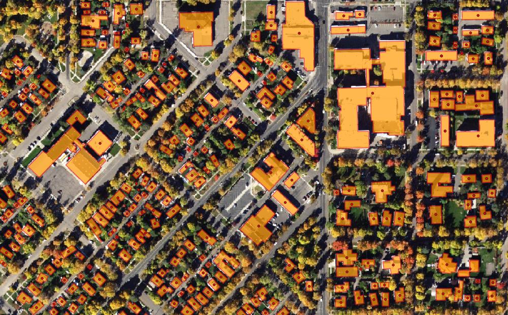
The US Building Footprints product provides GIS-ready building data to support a host of mapping and spatial analysis functions.
EarthDefine’s recently updated building footprint database contains over 156 million footprints of commercial and residential structures across the continental United States. The database is updated at least twice a year as newer imagery or lidar is acquired and the building footprints are re-extracted, with the update time depending on the volume of imagery that is being processed.
“For example, for a large state like Texas it can take up to a week which smaller states can be updated in a few days. Our current database was created by processing over 120 terabytes of color infrared imagery and we expect to process hundreds of terabytes of Lidar to further enhance the US Building Footprints dataset. We have started processing aerial imagery flown in summer 2020 as it becomes available and expect to update the majority of our building footprints by spring 2021.”
Parcel-level geocoding
EarthDefine’s building footprints are the latest generation of geocoding solutions, which have evolved from zip code-based centroids to street interpolated geocoding and, most recently, parcel-level geocoding. It is wrong to think that neural networks themselves perform parcel-level geocoding, says Jetly: “Rather think of neural networks as a class of new machine learning/AI algorithms that are enabling classification of new ground cover classes like building footprints, tree canopy or impervious surfaces, at continental scales. This was not possible even five years back using traditional machine learning methods. The advancements in computer vision and faster Graphics Processing Units (GPUs) are driving much of the innovation in this space.”
 He continues by stating that after acquiring the actual location of the building in a parcel, the address can be mapped to the exact location of the building versus some interpolated location like a parcel centroid, closest street, and so on. Also, most of this process is automated with select manual quality checks to ensure that there are no gaps in the output coverage. Furthermore, the company uses a commercial geocoding solution with some additional logic built in to flag and correct areas where no address is returned.
“We are also looking at additional address sources to further improve the address accuracy. The building polygon attribute fields also include Plus Codes which are like ‘street addresses for places that don’t have one. Plus Codes are based on latitude and longitude, and displayed as number and letters. These additionally help provide an alternative ‘address’ for places without one”, concludes Jetly.